Monday, June 27, 2016

Salton Sea: A Former Paradise Abandoned

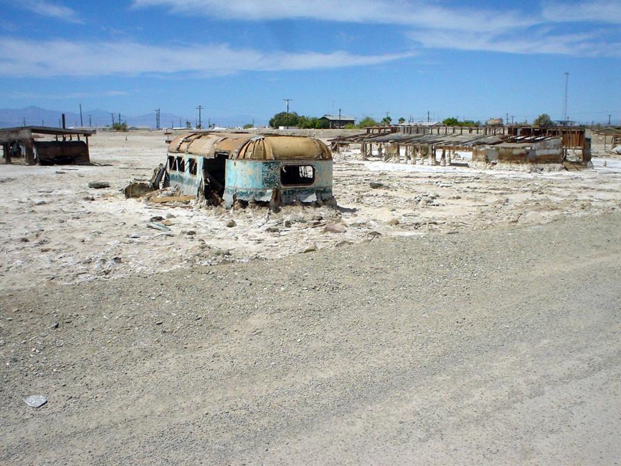
Abandoned buildings at Salton Sea
The Salton Sea is a semi-man-made lake in California, which sits directly on the San Andreas fault. It is home to numerous bird and fish species, some of which are endangered. Because it is an important stop along the Pacific Flyway, it is critical that it is safe for the birds that flock there.

Unfortunately, there have been several major die-offs for both the birds and the fish of the Salton Sea. And there is much controversy surrounding the cause of these die-offs.

The Salton Sea lies in a natural basin called the Salton Basin or the Salton Trough. This basin is very close to the Colorado River and it is easy for water in the area to drain into the basin because it is so far below sea level. The Salton Basin has been filled with water off and on as far back as 700 A.D. It was most recently filled in 1905.

In 1905 an irrigation canal headworks on the Colorado River broke and the river began pouring into the Salton Basin. Unfortunately, the town of Salton and some Native American land were submerged by the in-flowing water. Luckily, the area was not highly developed and all escaped what could have been a major disaster. Engineers were unable to fix the break immediately and so the Colorado River continued to pour into the Salton Basin for more than a year. Thus, the Salton Sea, as we know it today, was born. It is currently around 45 miles long and 20 miles wide.

The area of the Salton Sea has natural salt deposits and the Colorado River is relatively salty itself. Therefore, when the river poured into the basin and dissolved some of the natural salt, the Salton Basin became a salt lake. In fact, it is currently 25% saltier than ocean water because some of the water that flows in today is also salty. Because it is roughly 227 feet below sea level, no water flows out of the Salton Sea, only in. The lake is able to maintain its water level because of evaporation, but the salt doesn’t evaporate. So, what we are left with is a lake that constantly collects more and more salt, but does not dispose of it.

The Salton Sea is fed by the New River, the White River, the Alamo River and numerous agricultural drain offs and creeks. Therefore, not only water comes into the Salton Sea; fish do as well. There are many species of fish in the Salton Sea and it has become a very popular fishing spot for both humans and birds. In little more than one hundred years, the Salton Sea has developed an ecosystem that is critical to the survival of several endangered species. The problem is that it may not be a safe place for these animals.

A number of large-scale die-offs of fish and birds have occurred on the Salton Sea over the years. Some people believe that contaminants are coming into the Salton Sea from the drain offs and rivers and that they are causing the die-offs. Others believe that it is the excess of naturally occurring salt, nutrients and Selenium. One thing is agreed upon by both groups–something is killing these animals and something has to be done about it. Various organizations are looking into the problem and researching possible solutions.

The Salton Sea is a wonderful part of the California landscape and it is rather unique. It would be a horrible thing to lose all of the animals that grace the lake and only be left with what would essentially be a giant bowl of salt water and animal bones. Fortunately, we live in a time where it may be possible to stop the Salton Sea from “dying,” though we haven’t been able to stop things such as this before. However, with some elbow grease and awareness, a biological travesty can be avoided. Thankfully, we have that choice.


Wednesday, June 15, 2016

Hurricane Safety Tips

ISS Photo of Cyclone Katarina
An average of five or six hurricanes occur every year in the Atlantic and just one of these storms can leave a path of destruction through several states. States on the Atlantic coast are the most susceptible to hurricane damage. Therefore, if you live on the Atlantic coast, even in the northern states, it is important to be prepared for hurricanes.

Keep a First-Aid Kit 


Whether you plan to stay at home or to evacuate, you should keep a first-aid kit with you. (Pack it in the trunk of your car ahead of time, if you know you plan to leave in the event of a hurricane.) Even the smallest wounds should be cared for in an emergency to prevent infection. The last thing you want is a small scrape turning into a medical emergency when medical aid may not be easy to obtain.

The bare essentials for a first aid kit:
  • Bandages of all sizes
  • Medical tape
  • Scissors
  • Tweezers
  • Antibacterial ointment
  • Antiseptic
  • Gauze
  • Hand sanitizer
  • Ace bandage
  • Over the counter pain reliever/fever reducer 


Keep a Hurricane Kit


A hurricane safety kit should include items that will keep you warm, protected from the sun, fed, watered and clothed for a minimum of three days. If you are evacuating in the event of a hurricane, you may want to keep this kit packed up and ready to be placed in your car at a moment's notice. If you plan to stay home, keep the kit in waterproof containers in your home. You never know if you will be forced out of your home by damage during a hurricane. You want to have those essentials ready and dry.

A hurricane kit should include, at minimum:

  • A change of socks and underwear for each person
  • Sunblock
  • Flashlights, small battery-operated radio and extra batteries (packed in watertight plastic)
  • A necklace whistle (for drawing the attention of rescue workers)
  • At least one blanket per person (Pillows are a luxury. Only pack them if you have the room or you can carry them.)
  • One towel per person packed in watertight plastic
  • Waterproof strike anywhere matches
  • Baby wipes (helps keep you sanitary when shower facilities are scarce)
  • Enough water for at least three days (one gallon per day, per person)
Food:

Meal replacement bars, trail mix, peanut butter and crackers, canned meat, beef jerky, canned vegetables, canned fruit and anything else that keeps for long without refrigeration. Be sure to bring plastic eating utensils, plates and cups.

Be Ready When a Hurricane Warning is Issued


You want to have your kits ready long before a warning is issued. This way, you miss the rush to the grocery stores. In addition, you want to make sure your gas tank is full in case you have to leave. If you have a shelter, hotel or other safe place out of the area in mind, leave as soon as possible so you beat the evacuation traffic. You cannot do this if you are not prepared before the warning. Make sure to gather all of the family's essential medications when a hurricane is expected as well. You can bring them with you to the shelter.

If You're Staying Home, Make Sure Your Home is Safe


It is possible to be injured inside your home during a hurricane, even if your home is sturdy. There are a few things you can do to make sure you are as safe as possible inside your house during a hurricane, if you decide to stay. Of course, in the event of a strong hurricane, your best choice is to evacuate.

Board up your windows and doors. This is to prevent breaking windows and doors from flying through your house and hurting you. Make sure all of the things you need and you are in areas of the house that are as far from trees as possible. Shut off the gas lines in your house in case something breaks.

It is important to remember that no matter how much you prepare, a strong enough hurricane can render your preparation useless. Therefore, your safest option is to evacuate while evacuation is still possible. Even if you do evacuate, do not forget your kit.

Wednesday, May 18, 2016

Rabbits Are Destroying Natural Habitats in Australia

Wild rabbit
Courtesy of John Loo
Australia has been home to one of the world's most destructive invasive species for more than a century–rabbits. Rabbits can annihilate plant species while causing soil erosion that drives native species out of their habitats. They eat a lot and reproduce prolifically, making them a major problem for Australia.

In 1859, 24 European rabbits were released into the wild in Australia for sport hunting. In only 67 years, their numbers increased to an estimated 10 billion. Rabbits propagate their species quite aggressively. Female rabbits can birth up to five litters, each containing 4-7 offspring annually. This means that it would take a single breeding pair of rabbits 1.5 years to increase the population by 182 rabbits. The consequences of this hyper-breeding is seen everywhere there are rabbits.

Rabbits are burrowing mammals. When their population gets out of control, this burrowing behavior damages the soil and causes soil erosion. They also have a habit of stealing burrows from other burrowing mammals, when they don't have enough to support their population. They are not only stealing the homes of these creatures, but they are making the land incapable of supporting these creatures in the future.

Another aspect of local eco-systems that rabbits destroy is the food supply, which is actually another cause of soil erosion. Studies show that it takes only two rabbits on one hectare of land to keep the plants on that land from growing. They are solely responsible for the near destruction of Hibiscus insutaris, a local plant. Rabbits are also guilty of a habit called ringbark. They use their teeth to remove the bark of trees in a ring around them. This effectively kills the tree. They also eat the little saplings, which keeps the trees from coming back. Other animals find it difficult to compete with the rabbits for food. Roughly 1/8 of all of the mammal species in Australia have been eradicated as a result of rabbit infestation.

All of this destruction is costing the Australian government hundreds of millions of dollars a year. Because of this and the destruction of native species, several attempts have been made to wipe out the rabbit population in Australia. (Animal lovers will not like their methods, but there is no denying that something needs to be done before more animals are made extinct because of this invasive species.) In 1950, the rabbits were given the myxomatosis virus in an attempt to reduce the population. It worked. Nearly 100% of all rabbits in Australia were killed. However, some of the rabbits became immune to the virus and the population became problematic again within a few decades. In the mid to late 90s the method was tried again with a new virus. This virus kills millions of the rabbits annually, but this is still not enough.

There are currently hundreds of millions of rabbits in Australia. This may not be as bad as the billions that once were, but if efforts to reduce the population cease for even a few years, billions of rabbits would appear again. It is a constant job to keep these rabbits in check and there is no end is sight.

Sources

Invasive Animals CRC, Rabbits, retrieved 3/15/10, invasiveanimals.com/invasive-animals/rabbits/index.html

The Effects of Rabbits on the Australian Environment, library.thinkquest.org/03oct/00128/en/rabbits/effect.htm

Animal Planet, Weird True and Freaky, Outback Rabbit Invasion

Tuesday, May 3, 2016

Antarctica's Blood Red Waterfall


Blood falls

Blood Falls is a natural feature of the Taylor Glacier in Antarctica. It is located in the McMurdo Dry Valleys at the edge of the glacier. It pours out of glacier and into Lake Bonney. Its waters are the color of blood, which is odd when you consider its surroundings. There is nothing else in the area that matches its color. The glaciers and lakes are your typical blues and whites and the valleys are brown where the wind has swept away the snow.

Scientists, researchers and explorers have been pondering the possible causes of the coloration of Blood Falls for some time now. Early on, they thought that the color might come from algae. However, algae have never been known to survive below a glacier, and Blood Falls’ source is beneath the Taylor Glacier. Then there is the fact that the water is very salty. In other words, it is seawater. What is blood red seawater doing pouring out of a glacier in Antarctica?

Barry Lyons of Ohio State University and a team of scientists did a decade long study of Blood Falls. At the study's conclusion, Barry’s answer to the mystery of Blood Falls was that part of Taylor Valley was once covered with a saltwater lake that had come in from Ross Sea. The iron in the water had settled to the bottom of the lake and was later picked up by the Taylor Glacier. Now the salty, iron-rich water is pouring out of the edge of the glacier. This next theory is based on basically the same principle, but it goes even further with the addition of something that may be even more interesting than the falls themselves.

In early 2009, Jill Mukucki from Dartmouth’s Department of Earth Studies released a paper regarding her research, and that of her colleagues, on Blood Falls. In this paper, Jill basically agrees with Barry Lyons about the source of the salt water beneath Taylor Glacier. However, the paper’s explanation of the color is largely different. Jill and her colleagues discovered microbes that live roughly 1,300 feet inside of the glacier. These microbes supposedly feed on the iron in the seawater under Taylor Glacier. By feeding on the iron, they help to break it down, which gives Blood Falls its red coloring.

These microbes may have had ancestors that were ocean life. They have apparently adapted to the lack of light (and many other things) within the glacier. They have utilized the only real resource in Taylor Glacier–the iron–and turned it into food. This is the first indication scientists have ever seen that life can exist beneath a glacier.

Sources

(Note: article has been updated. These are the original sources from 2010.)

Blood Falls, Antarctica’s Dry Valleys, retrieved 1/17/10, earthobservatory.nasa.gov/IOTD/view.php?id=35535

Unusual Antarctic Microbes Live Life on a Previously Unsuspected Edge, retrieved 1/17/10, nsf.gov/news/news_summ.jsp?cntn_id=114488

Inmar, Mason, April 16, 2009, Glacier “Bleeds” Proof of Million Year Old Life Forms, retrieved 1/17/10, nationalgeographic.com/news/.../090416-blood-falls.html

Monday, April 25, 2016

How Gas Build-Up at Lake Nyos Killed More Than 1,000 People


One of the CO2 vents at Lake Nyos
Lake Nyos is a crater lake in northwestern Cameroon. It is one of only three lakes in the world known to be capable of causing a very unique sort of natural disaster. Lake Monoun, which is 60 miles to the southeast of Nyos and Lake Kivi on the Congo/Rwanda border are the other two, but neither of them has been as deadly as Lake Nyos. On August 26, 1986, 1,700 people in the vicinity of the lake died mysteriously. Animals in the area were also found dead. There were no signs of trauma or disease. It appeared as if these people just fell down where they stood and died. Some were even still asleep in their beds.

After the disaster, scientists turned to Lake Nyos for answers. It was noticed that the normally deep blue lake had turned a reddish brown color. This color lead scientists to suspect that the iron at the bottom of the lake had somehow made its way to the top, where it oxidized and temporarily changed that lake’s color. When the lake was studied, abnormal amounts of carbon dioxide were found at the bottom of the lake. This would lead them to the answer that they were looking for.

Two years before the Lake Nyos Disaster, a similar event had occurred at Lake Monoun. Thirty-seven people had lost their lives when they suffocated on CO2 that suddenly escaped from the lake. Apparently the same thing had happened at Nyos, but on a much larger scale.

There is an extremely large amount of carbon dioxide at the bottom of Lake Nyos because the lake does not naturally “turn over” frequently, the way most lakes do. The carbon dioxide enters the lake naturally and because the lake is very deep, the upper waters of the lake hold down the carbon dioxide. The waters are also unusually calm, and the lack of movement keeps the carbon dioxide at the bottom of the lake as well. When something does naturally occur to cause some of the lake’s water to turn over, the result is a massive release of the built up gas.

On the day of the Lake Nyos disaster, something occurred (scientists aren’t sure exactly what, but several good theories exist) that made the CO2 rise rapidly out of the lake, causing the lake to bubble tremendously and spray water into the air. Because CO2 is heavier than air, it didn’t disperse. It sank down into the valleys surrounding the lake in a cloud that is estimated to have been roughly 328 ft. tall. The cloud moved through the area at speeds between 12.42 and 31.06 miles per hour. The average running speed for a human is roughly 12 miles per hour. It is unlikely that anyone would have been able to outrun it, even if they had noticed that something invisible and deadly was moving toward them.

The cloud killed nearly every human and animal within a 15-mile radius of the lake. Because the carbon dioxide was in concentrations higher than 10%, it caused everything in the area that breathes to become asphyxiated. There were very few survivors. Some people that were high enough above the lake survived, others simply woke up two days later, after the cloud had dispersed. Some people, who were lucky enough to be inside their homes with the doors and windows closed, survived as well.

The carbon dioxide in Lake Nyos began building up again immediately after the disaster. It was soon realized that another disaster would be inevitable if nothing was done to prevent it. So, scientists developed a pump with a long pipe going to the bottom of the lake, which brings the gas to the surface. The pipe then empties out above the water line with a harmless spray of water and gas. At this time, there are not enough pumps on the lake to prevent another disaster. However, efforts are being made to install more pumps and ensure that nothing like the tragedy that occurred on August 26, 1986, will ever happen again.

Sources

The Lake Nyos Disaster, retrieved 11/24/09, geo.arizona.edu/geo5xx/geos577/projects/kayzer/html/lake_nyos_disaster.html

Fink, Micah, Volcanic Killers, Degassing Lake Nyos, retrieved 11/24/09, pbs.org/wnet/savageplanet/o/volcano/01/indexmid.html

Lake Nyos (1986), retrieved 11//24/09, geology.sdsu.edu/how_volcanoes_work/Nyos.html

Wednesday, March 23, 2016

The Moeraki Boulders of Koekohe Beach


Moeraki Boulders
The Moeraki Boulders
Moeraki Boulders are just one of the many naturally occurring oddities that are found on Koekohe Beach and surrounding areas in New Zealand. Some have likened the appearance of these boulders to the bowling balls of giants, who have long since abandoned their game. In a way, they do look like bowling balls because some of them are nearly perfectly spherical. This sort of boulder occurs naturally elsewhere, but the number of them in the area and the beauty of the surrounding New Zealand landscape seems to draw people to the Moeraki Boulders in particular.

Roughly 56 million years ago (during the Paleocene Epoch), small bits of wood, fossils and bones on the bottom of the ancient sea floor began to accumulate layers in what is now New Zealand. Over time, these small formations grew larger and larger in much the same way an oyster's pearl grows in size. The large, round stones that resulted from this process are known as septarian concretions. They eventually became trapped in the stunning sheer cliffs that grace the coast of Kohekohe Beach between Moeraki and Hampden, New Zealand.

When erosion began to take its toll on the cliffs, the ancient Moeraki Boulders were freed. Today, they are scattered across the landscape like errant marbles. Some are not spherical, but are oval instead. These Moeraki Boulders look like dinosaur eggs–really big ones, at that. Some of them have cracked open and revealed their softer, eroded interior. Some of these are big enough for a man to sit in, giving the appearance that he has just been hatched from the ancient stone. The biggest of the Moeraki Boulders is close to nine feet in diameter and weighs several tons.

The surfaces of the Moeraki Boulders are cracked, causing them to look like turtle shells. The reason for this cracking is yet unknown to science. We do know that the interiors of the boulders are weaker than the exteriors, yet the exteriors are cracked. Some of the boulders are much smaller than others. The cracked surface makes them look like large turtles half-buried in the sand.

An 1848 drawing by W.B.D. Mantell shows the Koekohe Beach with more of the Moeraki Boulders than are currently there, so we know they are slowly vanishing. However, more are still trapped in the cliffs, as evidenced by those that are only half-exposed today. There is no telling how many of them are still waiting to be revealed.

Sources

De Hek, Danny, retrieved 10/28/10, newzealandnz.co.nz/destinations/moeraki.html

Facts about Moeraki Boulders, retrieved 10/28/10, moeraki-boulders-facts.php

Evans, RJ, The Mysterious Moeraki Boulders, kuiositas.com/2010/09/mysterious-moeraki-boulders.html

Sunday, March 13, 2016

Interesting Facts About Iceland's Volcanoes

Fire spewing out of Eyjafjallajokull
during the 2010 eruptions
Courtesy of Ulrich Latzenhofer
Iceland and its volcanoes have been in the news a lot in the past few years. The Eyjafjallajokull volcano in Iceland was been very active in March and April of 2010. The ash spewing forth from this volcano resulted in the grounding of flights as far away as England, due to the danger it presents to airplanes. Prior to this tantrum, the Eyjafjallajokull volcano had not erupted for nearly 200 years. All of this attention serves to remind us that Iceland is a land of many volcanoes, some of which can have global consequences should they erupt. With that in mind, here are a few facts about Iceland's volcanoes that can give us an idea of what goes on there in the "land of fire and ice."

Hawaii gets a lot of attention for its volcanoes. This is because it was formed by volcanoes. Evidence of their activity is present everywhere there. Nonetheless, there are only two active volcanoes in the State of Hawaii. Iceland has between 20 and 30 active volcanoes. That is more active volcanoes than any other place on Earth.

The most active volcano in Iceland is Hekla. Hekla has an elevation of 4,892 feet. It is a stratovolcano that is located in southern Iceland. Hekla has erupted roughly once every ten years for the past fifty years. A Hekla eruption can come on with little to no warning and can last for weeks or months. Hekla was less active in the past fifty years. However, for some time, there was hardly a century that passed without at least one eruption from Hekla.

Iceland was formed from volcanic activity, like Hawaii. The American and Eurasian tectonic plate boundary goes through Iceland. The two plates pull apart, making it easy for lava to push through the gap. This is how Iceland was formed and why it has so many active volcanoes today.

In the past 500 years, nearly one-third of the Earth's lava output has spewed forth in Iceland. Furthermore, 83% of the world's sub glacial eruptions have occurred in Iceland. To put that into perspective, the area of Iceland is 39,707 square miles of land. The entire Earth has roughly 57,393,000 square miles of land area. Iceland is sure pumping out a lot of lava for such a small portion of the Earth.

From the above, you can clearly see why Iceland is called the "land of ice and fire." Of course, given its position on this Earth, there is a lot of ice in Iceland. However, residents can warm up by taking a dip in the large number of the geothermal spas there. Despite the scary number of active volcanoes, Iceland is easily one of the most beautiful and interesting places on Earth.

Sources

Volcanology Highlights, retrieved 4/16/10, volcano.si.edu/world/region.cfm?rnum=17&rpage=highlights

Volcanoes in Iceland, retrieved 4/16/10, kwintessential.co.uk/articles/article/Iceland?Volcanoes-in-Iceland/538

Seach, John, Hekla Volcano, retrieved 4/16/10, volcanolive.com.hekla.html